Property Record
2222 N James H Mcgee Blvd, Dayton, OH 45417
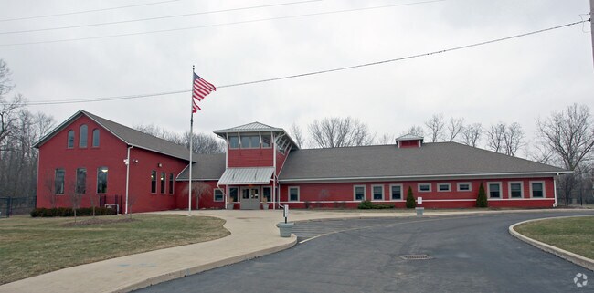


Property Detail
2222 N James H Mcgee Blvd
Dayton, OH
67670
R72-12115-0014
Montgomery
Municipalproperty
Ohio
AE The base floodplain where base flood elevations are provided. AE Zones are now used on new format FIRMs instead of A1-A30 Zones.
14
2024
0.63 AC
2025
West Dayton
003800
Cincinnati/Dayton
10,857 SF
NEARBY LISTINGS FOR SALE OR LEASE
DEMOGRAPHICS near 2222 N James H Mcgee Blvd
1 mile
3 mile
5 mile
2025 Total Population
10,730
86,430
166,102
2030 Population
11,220
89,918
171,321
Pop Growth 2025-2030
+ 4.57%
+ 4.04%
+ 3.14%
Average Age
39
39
39
2025 Total Households
4,697
37,573
69,766
HH Growth 2025-2030
+ 4.79%
+ 4.05%
+ 3.25%
Median Household Inc
$42,518
$40,385
$45,079
Avg Household Size
2.20
2.20
2.20
2025 Avg HH Vehicles
1.00
1.00
1.00
Median Home Value
$58,682
$74,015
$98,286
Median Year Built
1954
1953
1956
Nearby Places
Map Layers
Map Styles
 Street
 Aerial
Layers
 Traffic
 Biking
Places
Listings with unknown addresses are not visible on the map
- Restaurants
- Banks
- Shops
- Fitness
- Groceries
PUBLIC TRANSPORTATION
AIRPORT
James M Cox Dayton International
Drive
Walk
Distance
James M Cox Dayton International
23 min
11.8 mi
Freight Ports
Port of Toledo
Drive
Walk
Distance
Port of Toledo
182 min
156.2 mi
Nearby Properties
Address
Land Use
TOTAL SIZE
Lot Size
Zoning
Address
Land Use
TOTAL SIZE
Lot Size
Zoning
127,232 SF
7.96 AC
Address
Land Use
TOTAL SIZE
Lot Size
Zoning
134,515 SF
370.05 AC
Address
Land Use
TOTAL SIZE
Lot Size
Zoning
11.64 AC
Address
Land Use
TOTAL SIZE
Lot Size
Zoning
29,760 SF
5.13 AC
Address
Land Use
TOTAL SIZE
Lot Size
Zoning
767,771 SF
1.32 AC
Address
Land Use
TOTAL SIZE
Lot Size
Zoning
125,433 SF
92.08 AC
Address
Land Use
TOTAL SIZE
Lot Size
Zoning
188,584 SF
2.83 AC
Address
Land Use
TOTAL SIZE
Lot Size
Zoning
1.95 AC
Address
Land Use
TOTAL SIZE
Lot Size
Zoning
761,679 SF
5.09 AC
Address
Land Use
TOTAL SIZE
Lot Size
Zoning
11.83 AC
Address
Land Use
TOTAL SIZE
Lot Size
Zoning
158,144 SF
4.16 AC
Address
Land Use
TOTAL SIZE
Lot Size
Zoning
0.74 AC
Address
Land Use
TOTAL SIZE
Lot Size
Zoning
357,800 SF
1.22 AC
Address
Land Use
TOTAL SIZE
Lot Size
Zoning
2.67 AC
Address
Land Use
TOTAL SIZE
Lot Size
Zoning
170,977 SF
8.65 AC
Address
Land Use
TOTAL SIZE
Lot Size
Zoning
1.61 AC
Address
Land Use
TOTAL SIZE
Lot Size
Zoning
54.85 AC
Address
Land Use
TOTAL SIZE
Lot Size
Zoning
31.16 AC
Address
Land Use
TOTAL SIZE
Lot Size
Zoning
390,656 SF
47.47 AC
Address
Land Use
TOTAL SIZE
Lot Size
Zoning
6.25 AC
Address
Land Use
TOTAL SIZE
Lot Size
Zoning
8.82 AC
Address
Land Use
TOTAL SIZE
Lot Size
Zoning
23.29 AC
Address
Land Use
TOTAL SIZE
Lot Size
Zoning
24,530 SF
11.89 AC
Address
Land Use
TOTAL SIZE
Lot Size
Zoning
6.57 AC
Address
Land Use
TOTAL SIZE
Lot Size
Zoning
25.32 AC
Address
Land Use
TOTAL SIZE
Lot Size
Zoning
101,698 SF
19.06 AC
Address
Land Use
TOTAL SIZE
Lot Size
Zoning
401,486 SF
1.46 AC
Address
Land Use
TOTAL SIZE
Lot Size
Zoning
11.14 AC
Address
Land Use
TOTAL SIZE
Lot Size
Zoning
594,616 SF
6.52 AC
Address
Land Use
TOTAL SIZE
Lot Size
Zoning
86,512 SF
1.43 AC
The World's #1 Commercial Real Estate Marketplace
Connect with us
© 2026 CoStar Group
The information above has been obtained from sources believed reliable. While we do not doubt its accuracy we have not verified it and make no guarantee, warranty or representation about it. It is your responsibility to independently confirm its accuracy and completeness. Any projections, opinions, assumptions, or estimates used are for example only and do not represent the current or future performance of the property. The value of this transaction to you depends on tax and other factors which should be evaluated by your tax, financial, and legal advisors. You and your advisors should conduct a careful, independent investigation of the property to determine to your satisfaction the suitability of the property for your needs.